Work

Real places, real data lines.

Every project here states its extent, its coordinate system and the layers it carries. That line is where twin pipelines usually break, so we put it first. Hover a card to play it.

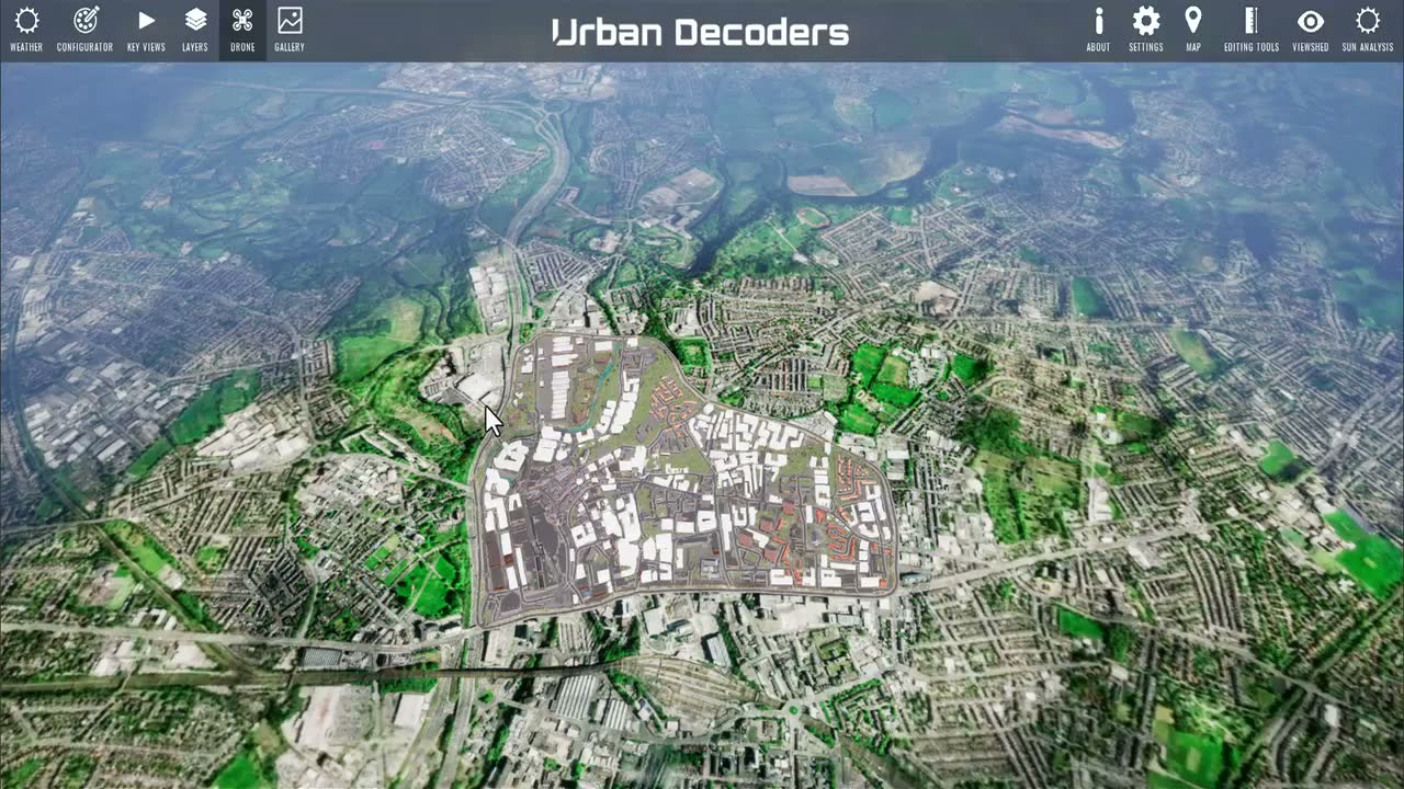
Aerial view of the Stockport East masterplan twin
Masterplan twin16 tools

Stockport East Masterplan

What it does. A working twin of the Stockport East regeneration area. GIS layers, key views, dynamic sun and weather, first-person and drone walkthroughs, measuring and section tools, solar and viewshed analysis, POI and transport data, all on one georeferenced base.

What it returns. A model that officers, designers and residents can move through and question. Every capability on this site was recorded inside it. Hover to play the flythrough.

Stockport East·British National Grid·Unreal Engine 5·GIS + transport + POI layers·1:39 cut
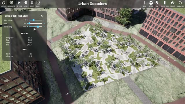
Urban configurator generating a park and the blocks around it, with plot area, units and green-space ratio on screen
ConfiguratorPark and urban space

Park and Urban Space Configurator

What it does. Plot area, unit mix, green-space ratio and block typology on live sliders. The park and the blocks around it regenerate directly in the twin, on the real site.

What it returns. Residential units, commercial tenants and green-space ratio recomputed as you drag: 1,200 m² plot, 25 homes, 10 commercial tenants and 35% green space in the configuration shown.

1,200 m² plot·25 units·10 commercial tenants·35% green space·live in the twin
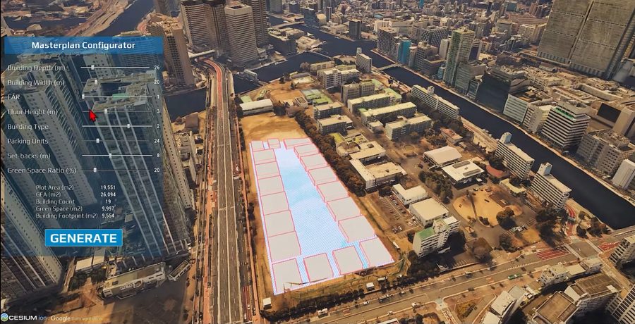
Arki Engine masterplan configurator parcel study at FAR 1
MasterplanDensity testing

Masterplan Configurator

What it does. Building depth, width, FAR, floor height, parking, set-backs and green-space ratio drive a parcel layout generated straight onto the real site in its real context.

What it returns. The same plot at FAR 1 gives 19 buildings and 26,094 m² GFA with 51% green space. Pushed to FAR 6 it gives 20 blocks and 123,639 m². Both in seconds, both measured.

19,551 m² plot·FAR 1 to 6·Cesium 3D Tiles·Arki Engine
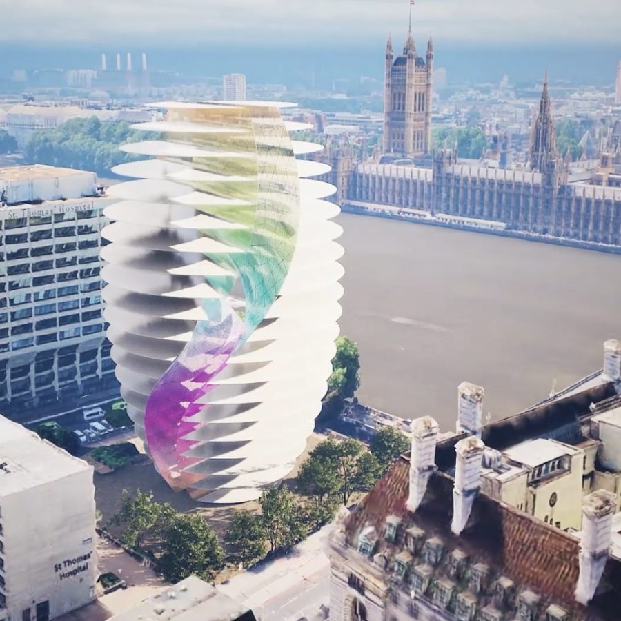
Office Tower T46 configurator over the Westminster skyline
TowerReal-time configurator

Tower Configurators

What it does. Floor height, radius, floor count, curvature and panel colour on live sliders. Office T46 sits on streamed 3D tiles of Westminster, so every option is judged against the skyline it would join.

What it returns. Glazed area, panel count and GFA recomputed as you drag: 864 glazed panels across 20 floors here, and a 30-level residential variant carrying 330 planted balconies over 14,584 m².

20 floors·864 panels·Westminster 3D Tiles·Unreal Engine 5
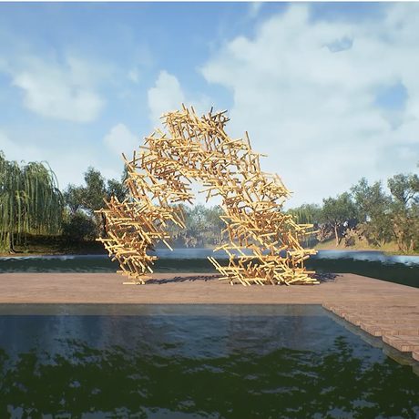
Generative timber pavilion of 755 aggregated components
PavilionGenerative structure

Pavilion Configurator

What it does. Component count, shape type and material aggregate hundreds of individual members into a buildable structure: 755 timber components across 2,257 m² in one study, 1,000 across 2,140 m² in another.

What it returns. Material swaps regenerate the identical geometry in timber, colour-coded stock or translucent polycarbonate. One slider, a different building.

755 components·2,257 m²·3 material states·Arki Engine
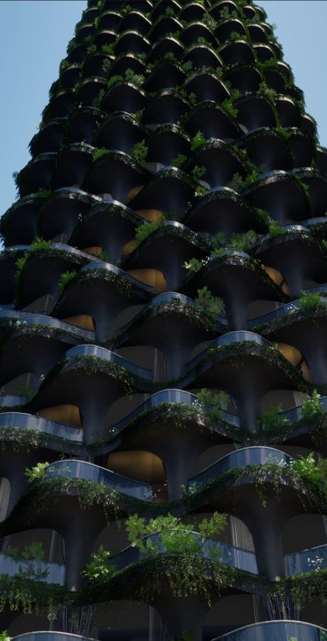
Vertical-garden residential tower configurator
ResidentialLive schedule

Vertical Garden Tower

What it does. Site dimensions, level count, floor height and balcony count rebuilt in seconds, with planted balconies distributed across the facade.

What it returns. Areas and unit counts recomputing as the sliders move. The demo that shows what every place we model can do.

30 levels·330 balconies·14,584 m²·Arki Engine

The configurators live in the Lab, with the Grasshopper definitions behind them.

Start a twin

Your place, with its own data line.

Send a site boundary and we'll come back with a tier, a timeline and the layers your decision needs.